121 Golgar Ginnels walk
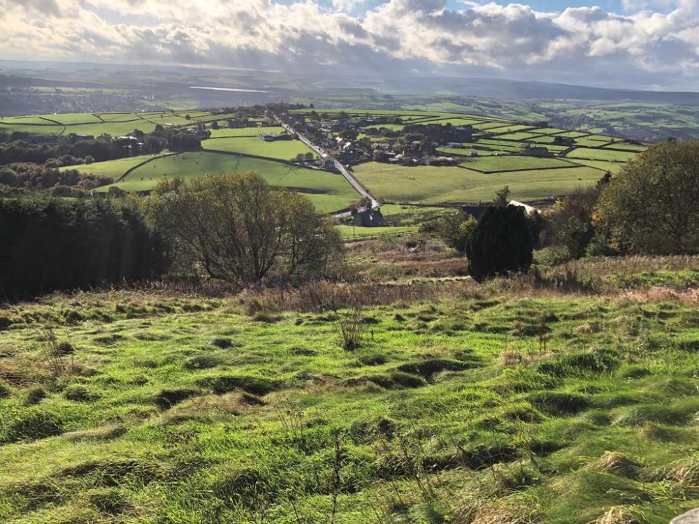
Walk Summary: 6 mile circular walk from Golcar starting outside the church taking in the Golcar Ginnels, great views, a Wuzzle Stick Post and the excavation of a Roman Road.
Walk starting point: Weavers Shed pub (closed indefinately Sept 2024)
Locality: Golgar
OS Grid reference: SE0998915780
Area: West
Distance miles: 5.8
Ascent meters: 295
Time hours: 3.3
Pub & Locality: Weavers Shed at Golgar
Parking: On road nearby. Difficult parking in village
Public Transport: Buses between Holmfirth and Huddersfield every 20 minutes. 310 314 316, then Stotts bus 301 to Golcar getting off Knowl Road Arthur Street with short walk to pub. Journey time circa 1 hour. Check bus times.
Walk Description: The first section of the walk utilises part of the Golcar Ginnels Trail, which is signposted and described on a leaflet available at the Golcar museum and a variety of outlets. This may be helpful in navigating the intricacies of the Ginnels but is not essential since our walk is described as follows:
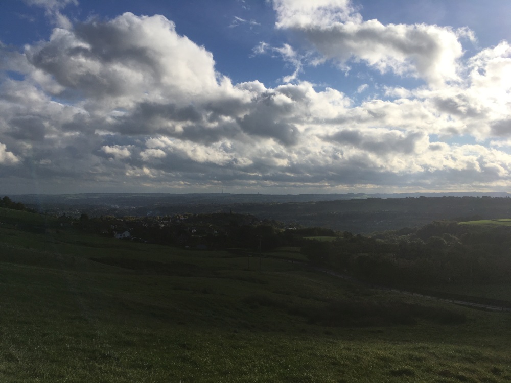
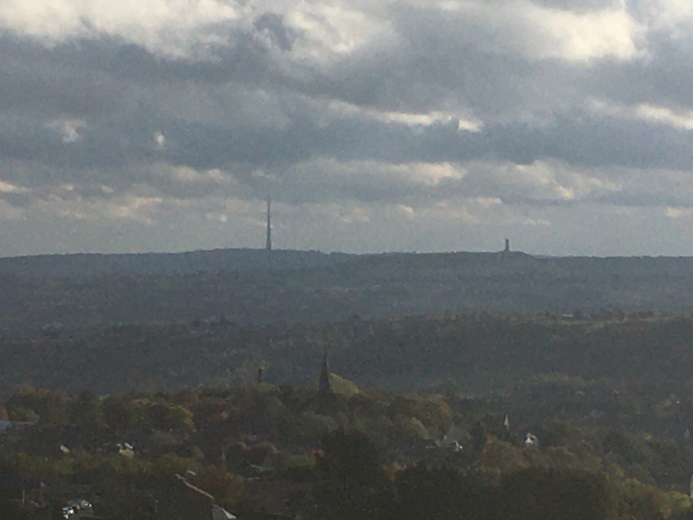
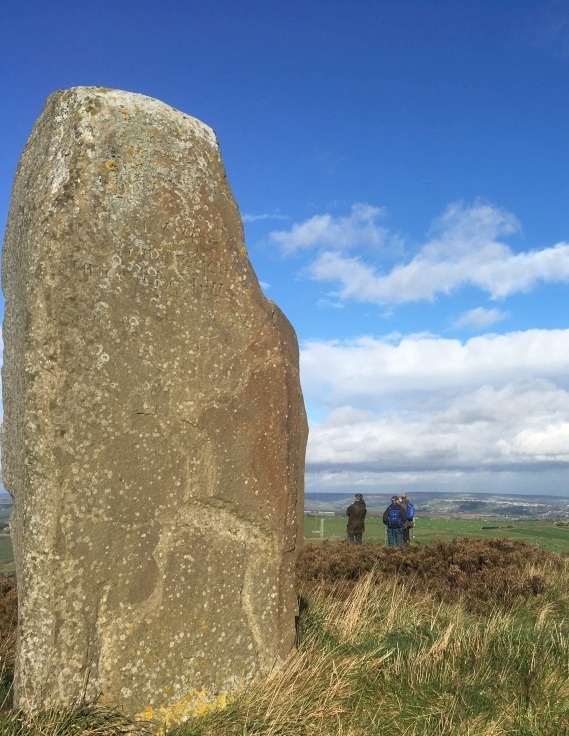
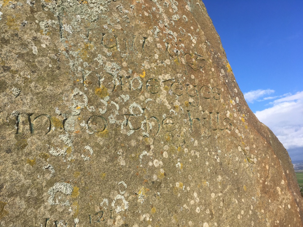
Start your walk outside the main gate of St John’s Church and cross the road (Church St) in a southerly direction, turn left, and note a footpath sign indicating the start of the Trail, down the first of the ginnels, down the steps behind the telephone box. Follow the path between the houses (Ginnel 1), descending to a metalled road. Bear left and immediately right down (Ginnel 2) onto another metalled road. Turn left again and on your right is (Ginnel 3) -Bell Oyle), follow the ginnel down in front of the houses. Take the steps down Handel St and turn left. After 5 houses a passage way goes up on your left (Ginnel 4), bringing you up onto Rockfold. Turn right and almost immediately right down more steps (Ginnel 5), which brings you back onto Handel St. Turn left and walk along Handel St to the converted school building on your left. On your right, steps descend (Ginnel 6), to bring you onto James St. Cross the road and turn left to descend another set of steps (Ginnel 7 – Alphabet Steps), which bring you out onto Scarhouse Lane. At this point your route leaves the Ginnel Trail, so if you are using the leaflet put it safely away for future use. Having reached Scarhouse Lane, turn right and on reaching a junction turn left. As the road turns sharply to the right, note a lane on the right, which is your route. This gives access to houses which are passed on your right. At the end of this lane turn right and after a few metres take a footpath on the left. This passes behind houses and joins a cobbled and walled path, which you follow to the right, past the Baptist Church ( also back on the Ginnels Trail). Continue straight ahead up to Brook Lane, where you turn left. After 200m take a footpath on the right and follow it up to Clay Well where you turn left and keep following as it becomes Small Lane and then Ridings Lane. You are now leaving the village and at the end of Ridings Lane take the path straight ahead through woodland, ignoring a path to your right. This leads up to Slades Rd., where you turn left and after 300m take a path on your right. This steep but well constructed path forks left to cross Pike Law Rd. and directly onto a path through rough and scrubby grassland. When it reaches a road, turn left and then right as it joins Halifax Rd. There is a short stretch here without a pavement, so take care on this relatively busy road. After 150m, at the top of the slope, take the lane on the left, past farm buildings .Follow this towards the mast ahead and as the track turns to the right, keep straight ahead through a stile or gate and onto a path across a field. At the end of the field is a stile where the main path continues ahead, but a lesser path to the left can be accessed over a derelict wall. This is a narrow path through heather but is firm underfoot and easy to follow. Fine views are presented from this section of Rocking Stone Hill as the path swings right, above old quarries. Eventually it returns to the path which you turned off earlier and where there is the substantial reclamation of Rocking Stone Quarry ahead. Turn left to avoid the quarry workings and descend steeply to cross a stile and enter woodland. Follow the path as it swings to the right and then soon exits the woodland by a stile, to reach the quarry access road. Turn briefly right and then take the track on your left to a gate and a high ladder stile. The path leads up to the splendid viewpoint of Wholestone Hill, where there is a modern standing stone. Having absorbed the vista, return to the path and continue left until a stile on the left is used, followed by another, to enter woodland and a path along the top of the escarpment of Wholestone Moor. At the bottom of the slope is the M62 but yours is a world away from it (except for the noise). Keep following the path until a stile on your right is reached and cross it into a field. Follow the edge of the field until it meets a path, with woodland ahead and to the left. Join this path and head across the field towards the mast. At a stile, take the lane ahead, (1) past the mast and onto the lane used previously. Returning to Halifax Rd., turn left and after 200m note a track on your right and a footpath which heads through heather, in a north easterly direction. This continues in a generally straight line across Longwood Common to meet Nettleton Hill Rd. At the road turn right, ignore a road on your right, then fork right, with houses on your left. As the road bends right, keep left, descending very steeply down the cobbled Moles Head. On reaching the houses at the end of the road, keep right onto a path past a garden, then turning left onto a field path, which heads towards, and crosses Clay Wood Brook. The path is clear as it crosses rough grassland with some wet patches as it approaches modern housing. As Hollin Hall Lane is reached , follow it to Leymoor Rd, where turn right. In 150m take Field Head on the left and this becomes a well used urban path to take you to the main road (Knowl Rd), and turning right takes you back to your start point.
Other comments and Points of Interest: (1) Recent excavations in this area have revealed what appear to be Roman road remains. Since the Roman fort at Slack is close by and a connection to the fortlet at Castleshaw in Saddleworth must have existed, the route of such a connection has not, to date, been confirmed. These recent excavations will no doubt help in defining this route but they are not in the expected position, so the debate goes on.
(2) Although not strictly on your route, a very short detour at the start or finish, down an entry by the right side of the museum (as you view it from Church St) will be of great interest to those knowledgeable in wuzzling and no doubt intriguing to those who aren’t. To those in the latter category, the essential requirements for wuzzling are a hole in a wall, a stick, some wet cloth and a strong armed operative. Golcar has provided all these in days past. With some diligence, the wuzzle hole will be found in the wall on the left, the other requirements are transitory so will have to be imagined. To wuzzle, the stick is draped with wet cloth and one end is inserted into the hole. The other end is firmly grasped and twirled rapidly. Depending on the programme chosen, this can be a lengthy and tiring process. It will of course be recognized that this is an early iteration of the spin dryer but is handraulic rather than electrically powered.
Please include the walk name or number when commenting on an individual walk.