144 Marsden Butterley round
Walk Summary: Easy 4.9 mile circular walk from Marsden down Wessenden Valley, over Butterley reservoir Dam and up to Pule Hill and back to Marsden.
Start : New Inn pub at Marsden or Railway station car park
Locality: Marsden
Area: West
Start OS Grid reference: SE0498111515
Start What3words : fallback.monk.chill
Difficulty: Easy
Distance miles: 4.9
Ascent meters: 337
Estimated Walk Time hours: 3.0
Pub & Locality: New Inn at Marsden
Parking: Street parking nearby
Public Transport: Bus 335 from Holmfirth to Slaithwaite Carr Lane then change to Bus 935 to Marsden. Journey time circa 1 hr 10 min. Alternative with similar journey times Bus 310 Holmfirth to Huddersfield then Transpennine train to Marsden.
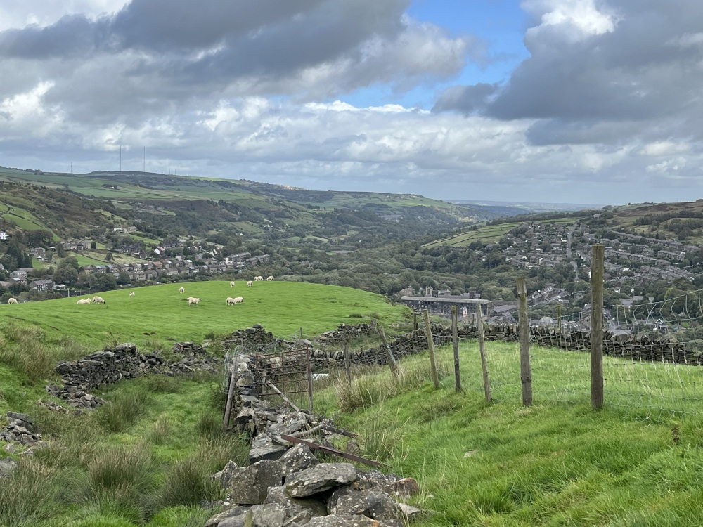
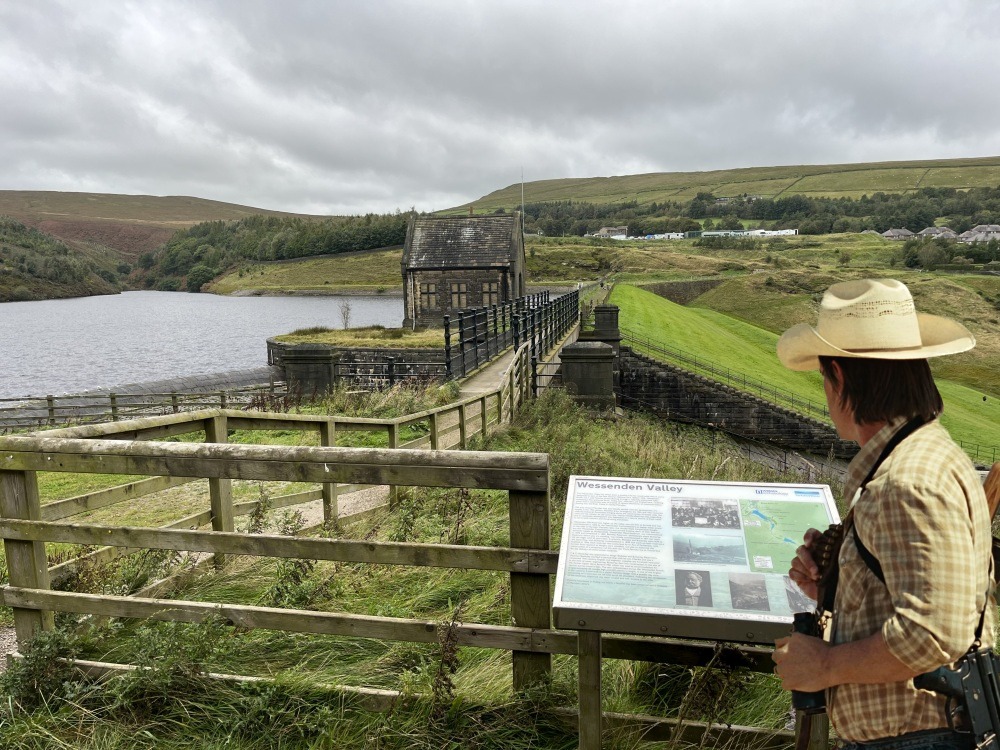
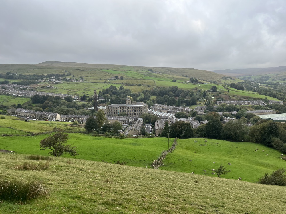
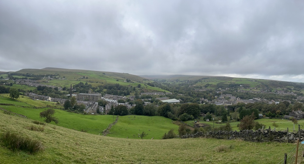
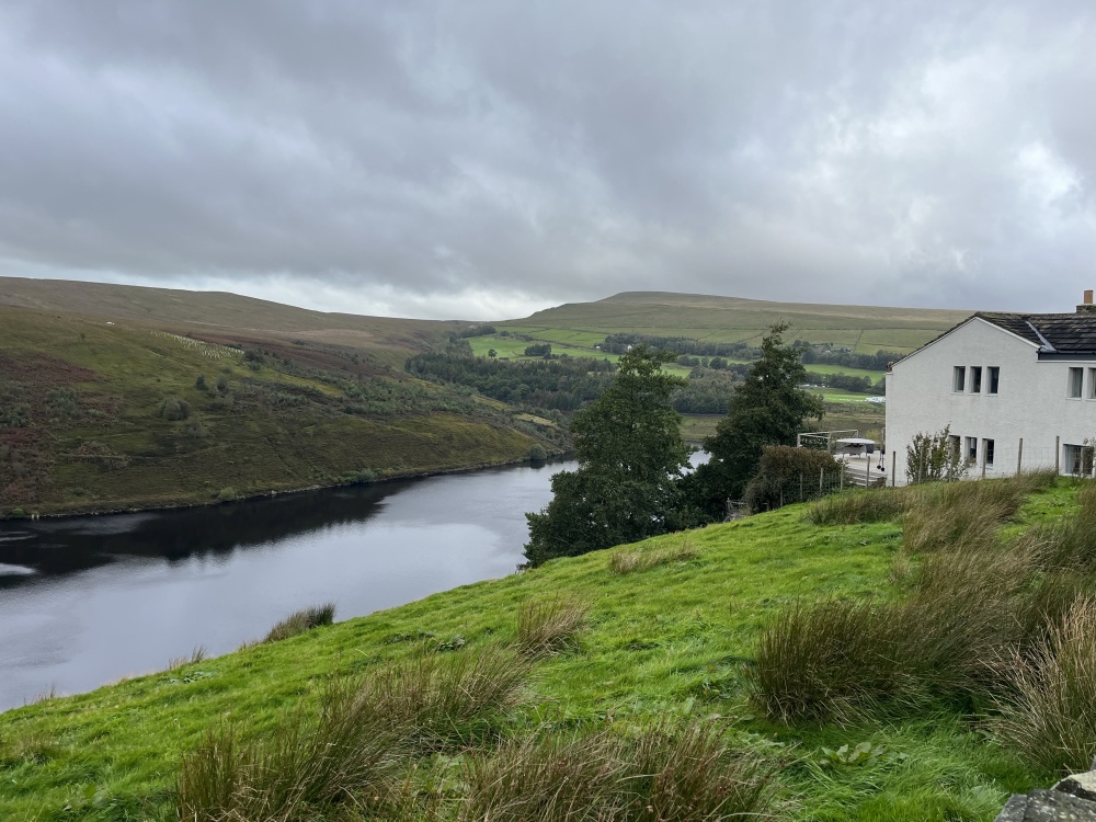
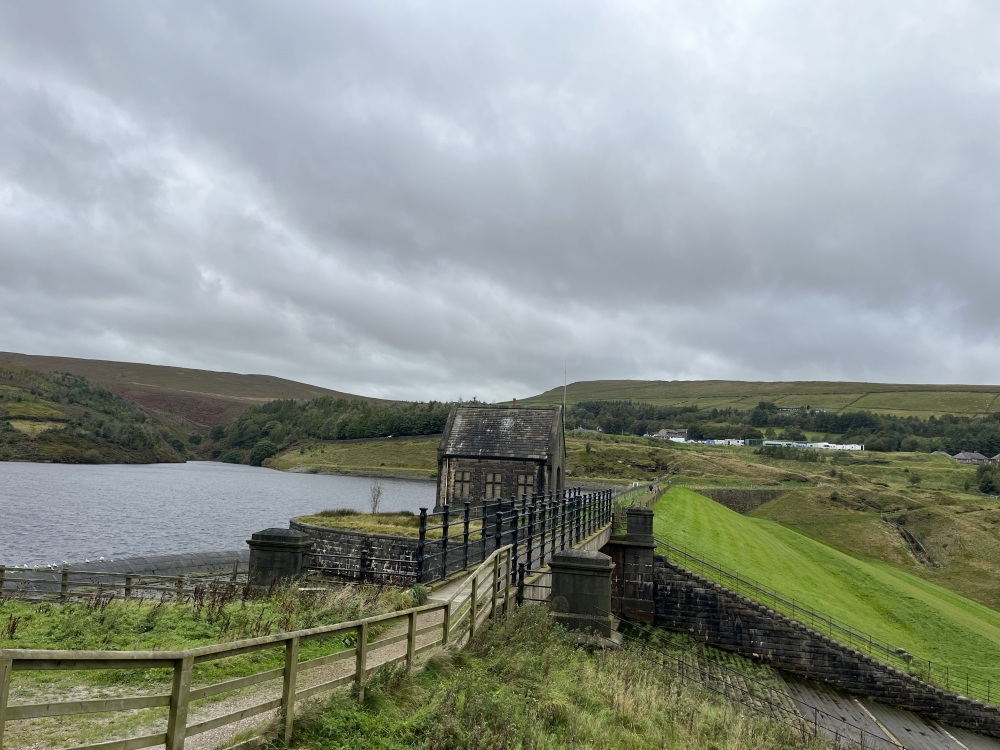
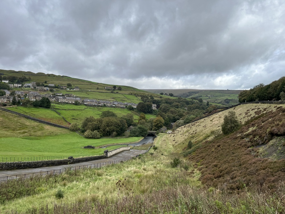
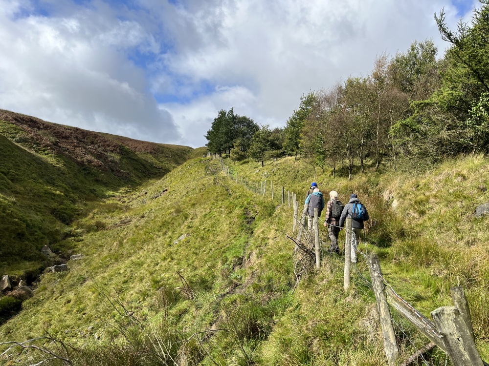
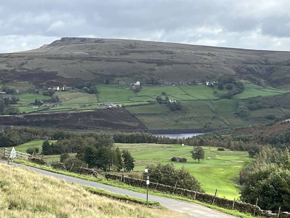
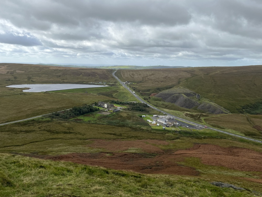
Walk Description: Start from the Railway station car park in Marsden and walk down Station Rd., towards the village centre. Keep on through the village on Peel St., up to the A62, where cross on the pedestrian crossing. Continue straight on to reach Carrs Rd., which you cross to join a signed footpath a little to the left. This is a lane which is followed up, to reach farm buildings where a sign leads you left, past stables and then past the farm buildings on your right. The path then narrows and is a little awkward under foot as it climbs and tends to the right. A path junction is soon reached where you pass through a gate and take the path straight ahead. Continue past a ruin and farm buildings to join the metalled Binn Lane. Turn right and follow down until a farm lane on your left, opposite farm buildings on your right. Continue along this lane, passing a farm on your right. The lane now becomes a field path (1) and continues straight ahead until it meets a path where you join to the right. There is now a prominent and very old wall on your left (2) as the path descends through old woodland (3) to reach the track which services the Wessenden Valley. Join this track and turn right, towards Marsden. When the path across the Butterley reservoir dam is reached, on your left, take it and the continuing path, tending right on the other side. About 50m beyond the dam there is a path on your left, across disturbed land and heading towards Hemplow Wood. A high wall stile gives access to the path through the wood, keeping close to the wall on your left. There is an alternative path which keeps to the reservoir side of the wall and eventually rejoins the “official” path. Now the single path approaches a wall, where the path tends right and climbs up through trees. There are various routes but generally keeping to the highest up the slope is preferable. You are now walking alongside, but below the Marsden golf course and this becomes apparent as you reach the end of this section through the wood. Pass over an awkward stile and keep to the left to reach Mount Rd. Cross the road and climb a short steep bank to reach Old Mount Rd., which is also crossed to take a faint path ahead, up a grassy slope. At a rough track, join it and continue up, keeping the quarry on your right hand side. The path continues up and tending left to join a path, which you follow to the left, aiming for the summit of Pule Hill. There is no difficulty following this path as it steepens and then eases as the summit stone pillar is sighted. Having admired the view, a prominent path along the escarpment is followed northwards, above a quarry, until a ramp from the left is reached and an indistinct path on the right is taken. Although the start is not obvious, the path soon becomes clear as it crosses Brown Hill and eventually reaches a path which runs parallel with the vehicle track serving Hades Farm (and others). Follow the path past an old delph and as it reaches the track, cross over and down a steep bank to a gate at a junction of walls. Pass through the gate and whilst the track is heading in your desired direction, it is wet and rough, so better use the field on the right. As a wall is approached keep to the left, where the path will be seen descending to Manor Farm. Pass through a gate at the farm and keep the building on your right to then pass between it and outbuildings. The track serving the farm is then taken down to Old Mount Rd where you turn left to reach the A62. Cross the road and take Church Lane, keeping the church on your left. Station Rd. is reached after crossing a bridge and turning left takes you back to your start point.
Other comments and Points of Interest : (1) The relatively flat fields to your left have been suggested as being an early cattle farm. If so this could be the site of a Grange, ie associated with a Cistercian monastery.
(2) The distinctive stone wall on your left has been proposed as being quite possibly the oldest in the Colne Valley. It is likely to be formed from stone clearance from the creation of the fields above.
(3) The woodland which you are passing through is an example of the landscape that existed here before farming or “improvement”.
Please include the walk name or number when commenting on an individual walk.