071 Marsden Cupwith reservoir round
Walk Summary: Easy 5.3 mile circular walk from Marsden climbing up to Cupwith Reservoir, then along the Colne Valley Way towards Cop Hill then back down to Marsden
Start : Riverhead Brewery Tap pub in Marsden
Locality: Marsden
Area: West
Start OS Grid reference: SE0489511644
Start What3words : offline.proves.tried
Difficulty: Easy
Distance miles: 5.3
Ascent meters: 289
Estimated Walk Time hours: 3.0
Pub & Locality: Riverhead Brewery Tap at Marsden
Parking: Street parking near pub
Public Transport: Bus 335 from Holmfirth bus station to Slawit then Bus 938 to Marsden. Journey time circa 1 hour 10 minutes. Check bus times.
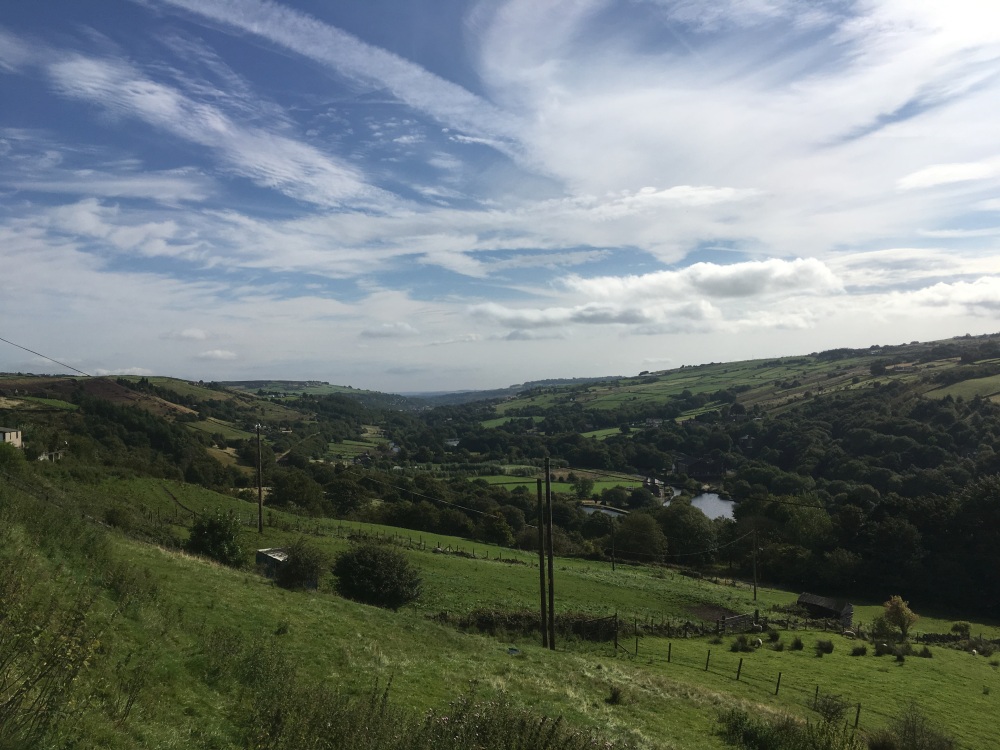
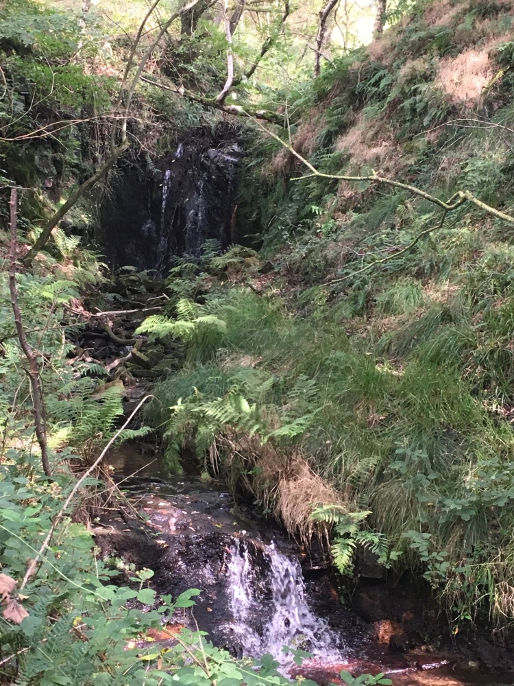
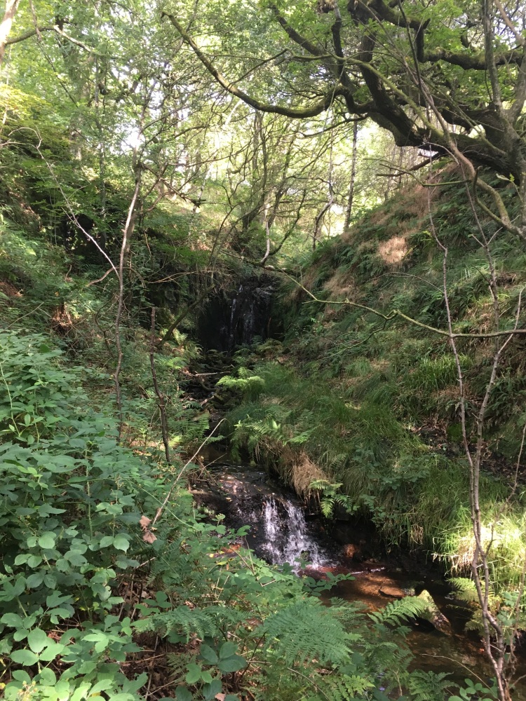
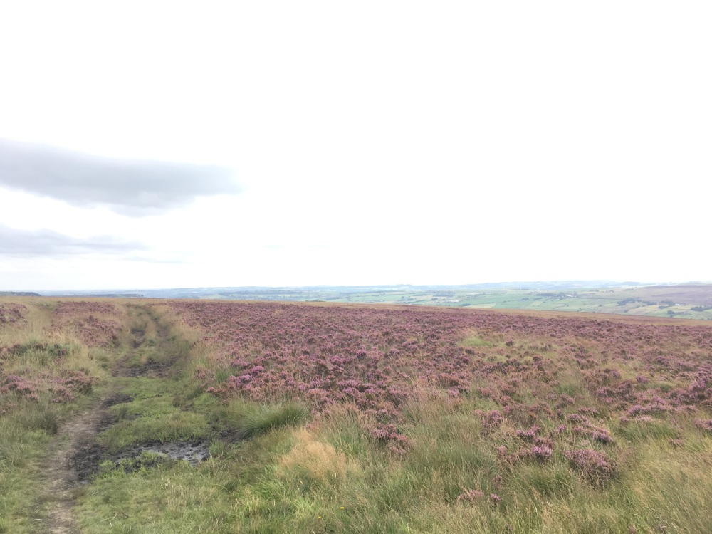
Walk Description: Start from the railway station car park in Marsden, walk past the National Trust office and a bus shelter to pick up the canal towpath ahead. Follow the towpath westward to Tunnel End and keeping the old warehouse on your right take the tarmacked road up to a crossroad. Keep straight ahead, following footpath signs and through a pedestrian gate keep ahead through a garden, past a house on your right. The path leads up to a pedestrian gate and a lane which is followed to the right. Follow the lane until High Fall Farm is reached and take the signed footpath to the left. The path climbs steeply until it meets another track, Stone Folds Lane. Take the lane left, possibly through a wet and muddy section, until after about 120m there is an area of tree planting on your right, which is entered and an indistinct path follows the wall on your right (SE). As the end of the planted area is reached the path turns left and a stile to the right gives access to a well-used track, Huck Hill Lane, also part of the Colne Valley Circular Walk. Follow this left, on frequently rough and wet ground where a ruined wall can provide a drier alternative route. Cross a stream, where boards give some assistance and continue up the path until a signpost and substantial bench are reached. Turn right and follow the path across moorland until a tarmacked road is reached. The road to the left is called Coal Gate, presumably from former use. Keep straight on along the road, Old Ground, until after about 250m there is a lane on the right and after a further 50m there is a track, again on the right. Follow this track as it becomes a sunken path to the left and leads down to Marsden Lane, which is followed downwards to the right. At the first building on your right take the signed path in between the house and outbuildings, through gates and across a riding arena, past habitual obstructions. The path is clear on the ground and leads to a junction where the path turns briefly left and then right, effectively straight on. This is a wet area but there are boards which provide some assistance. The path continues ahead, following a wall to the left before coming to a high stile formed by steps over a wall and then descends steeply. In the steep sided valley, the path turns right before a stream is reached and descends on a narrow path to a simple bridge across the stream. It then climbs steeply through woodland on a rough and sometime slippery path. There are overgrown steps cut into the bank side and some useful hand holds are provided by tree branches and trunks. At the top of the slope the path turns right towards Netherwood Farm and passes across the front of the building to a lane. Turn left, down the lane and after about 60m take a footpath on the right, through a stile. Follow the field edge path to another lane, where again, a left turn is followed by a right as the path continues to Lower Green Farm where it joins and follows the drive to the farm. Passing through a pedestrian gate the path joins Spring Head Lane, which is followed, straight ahead, becoming narrower towards its end, before opening out again into the tarmacked Spring Head Lane, descending towards Marsden station. At the bottom of the lane, turn right and then left, over the railway and back to your starting point.
Other comments and points of interest: TBA
Please include the walk name or number when commenting on an individual walk.