043 Holme Moss Ramsden round
Walk Summary: Hard 7.2 mile circular from Holme village, Issues Road and track to Kaye Edge and Holme Moss car park, along Lightens Edge, down Ramsden Clough to Brownhill reservoir and back to Holme.
Walk starting point: Fleece Inn at Holme
Walk Difficulty: Hard
Locality: Holme
OS Grid reference: SE1077405865
Area: South
Distance miles: 7.3
Ascent meters: 298
Time hours: 3.5
Pub & Locality : The Fleece Inn at Holme village
Parking: On road nearby. Difficult parking in village
Public Transport: Bus 314 every hour from Holmfirth Bus station to Holme. Check bus times.
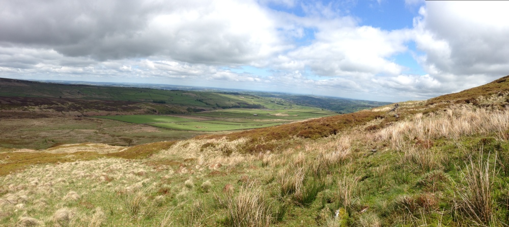
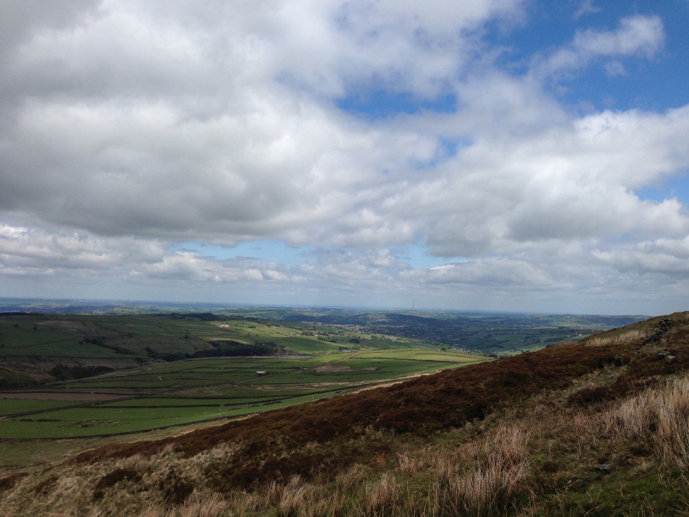
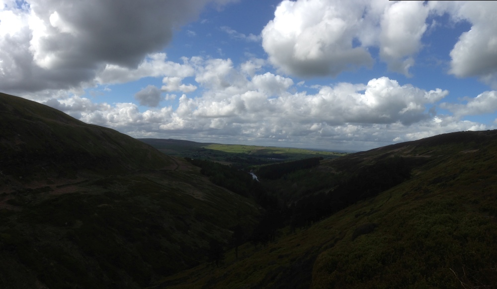
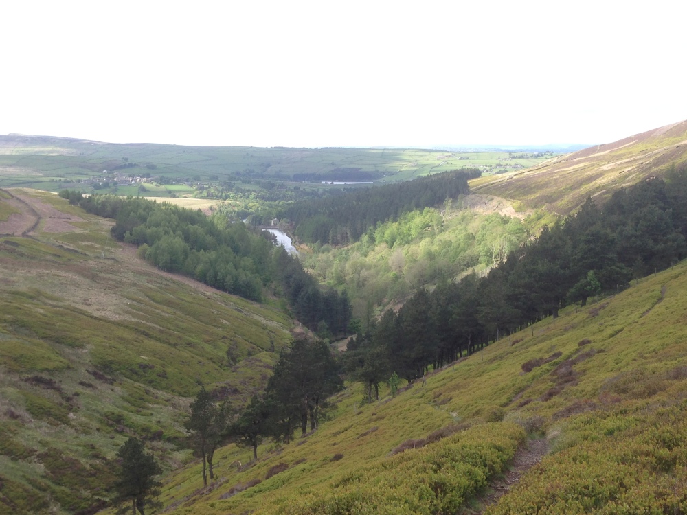
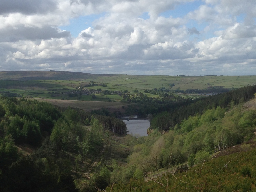
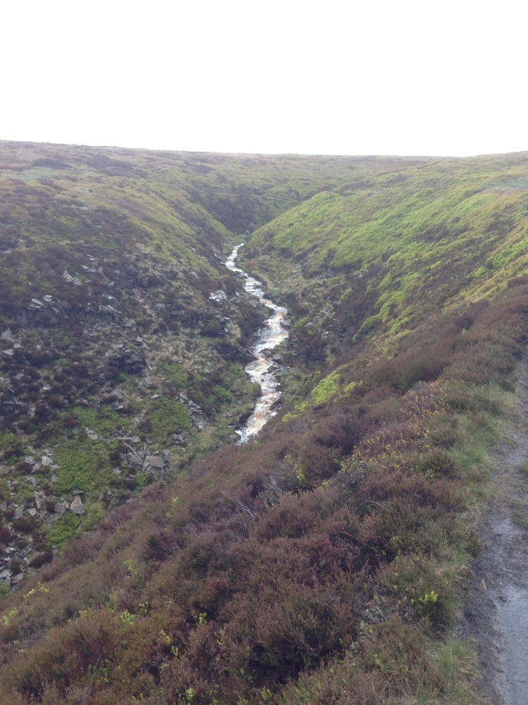
Walk Description: Starting at the Fleece Inn 9n Holme, head N along the village road before turning W onto Issues Road and follow the rising metalled track as it climbs steadily between drystone walls to meet the open moor. At a gate turn left off Issues Road up Cliff Road. Continue ascending on the broad stony byway Cliff Road, keeping the boundary fence close on your left, until the gradient eases near the plateau edge of Kaye Edge (1). Maintain direction S on the track, now rougher underfoot, and follow it as it runs parallel to the A6024, gradually gaining height until you reach the Holme Moss car park (2). From the car park, take the signed footpath E, keeping to the moorland track that skirts Lightens Edge (3), enjoying an extended traverse with wide views across the Holme Valley. Where the path begins to dip, bear NW, descending on a clear, sometimes eroded path, past a steep gorge Monkey Nick (4) in the upper reaches of Ramsden Clough, then exit by the Shooting Butts. Cross the small clough stream by stepping stones and follow the contouring path along the hillside above the wood until merging with a broader track into an old stone quarry. Continue N above Riding Wood reservoir, descending steadily with Brownhill Reservoir (5) coming into view below. At the junction with the reservoir access road by the carapark and picnic tables, turn W accross the upper reservoir dam embankment and follow the track around the northern edge of the reservoir, dipping down to cross over Rake Dike via a small wooden bridge. Follow the track up the bank on he other side and across fields to the outskirts of Holme. Re-enter the village via a gated footpath with the Underground House (6) on the left, emerging by Holme Castle, and walk S through the village back to the Fleece Inn.
Other comments and points of interest: (1) Kaye Edge – a pronounced moorland lip marking the transition between enclosed farmland and high peat plateau. In the 19th century it was notorious for wandering packhorses disappearing into hidden groughs during fog, prompting locals to fit their animals with small bells.
(2) Holme Moss Car Park – a well-known viewpoint near the old BBC VHF radio station tower. In the 1950s engineers working here reported their tools mysteriously migrating overnight—later blamed on curious ravens that had learned to lift wire-mesh covers.
(3) Lightens Edge – named, according to local lore, for a shepherd who claimed the sky “lightened twice” here during an unexplained atmospheric phenomenon in 1783. Some say it was an early sighting of the Great Meteor of that year.
(4) Monkey Nick – steep heather covered gorge, particularly dramatic after heavy rainfall. Known to locals by this name since 1852 when a monkey was seen leaping on the rocks and the animal was shot by a local game keeper.
(5) Brownhill Reservoir – completed in 1935, it flooded a once-productive hay meadow reputed to conceal a buried horse-drawn cart lost during a winter storm in 1888. Divers searching in the 1970s found only submerged fenceposts and a surprisingly intact cast-iron gate.
(6) Underground House – well known underground ‘hobbit’ house built by local architect Arthur Quarmby as his residence.
Please include the walk name or number when commenting on an individual walk.