044 Marsden West Nab round
Walk Summary: Hard 8.6 mile circular walk from Marsden up to Shooters Nab, West Nab, part Pennine Way and back to Marsden.
Start : Riverhead Brewery Tap pub in Marsden
Locality: Marsden
Area: West
Start OS Grid reference: SE0489511644
Start What3words : offline.proves.tried
Difficulty: Hard
Distance miles: 8.6
Ascent meters: 419
Estimated Walk Time hours: 4.9
Pub & Locality: Riverhead Brewery Tap at Marsden
Parking: Roadside in central Marsden
Public Transport: Bus 335 from Holmfirth bus station to Slawit then Bus 938 to Marsden. Journey time circa 1 hour 10 minutes. Check bus times.
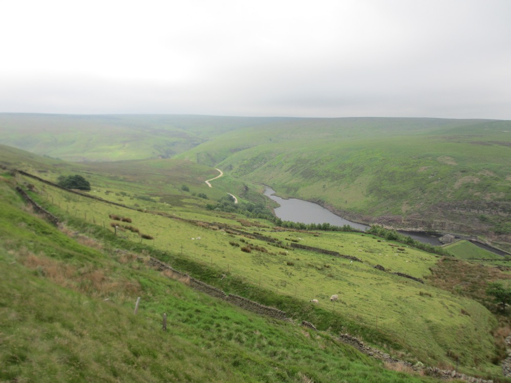
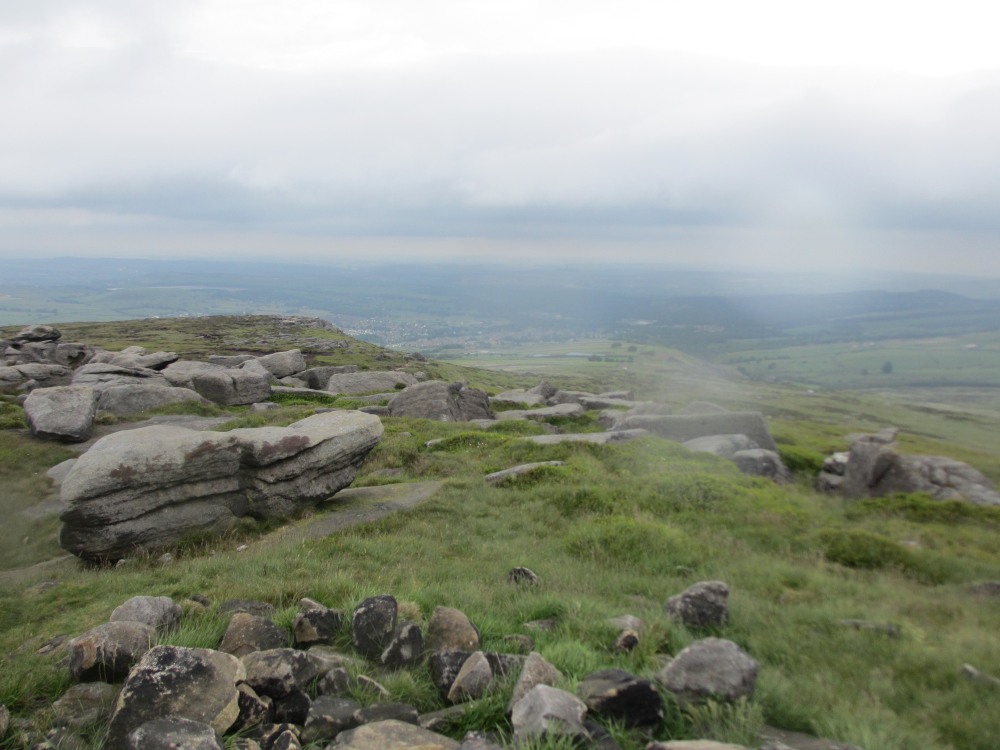
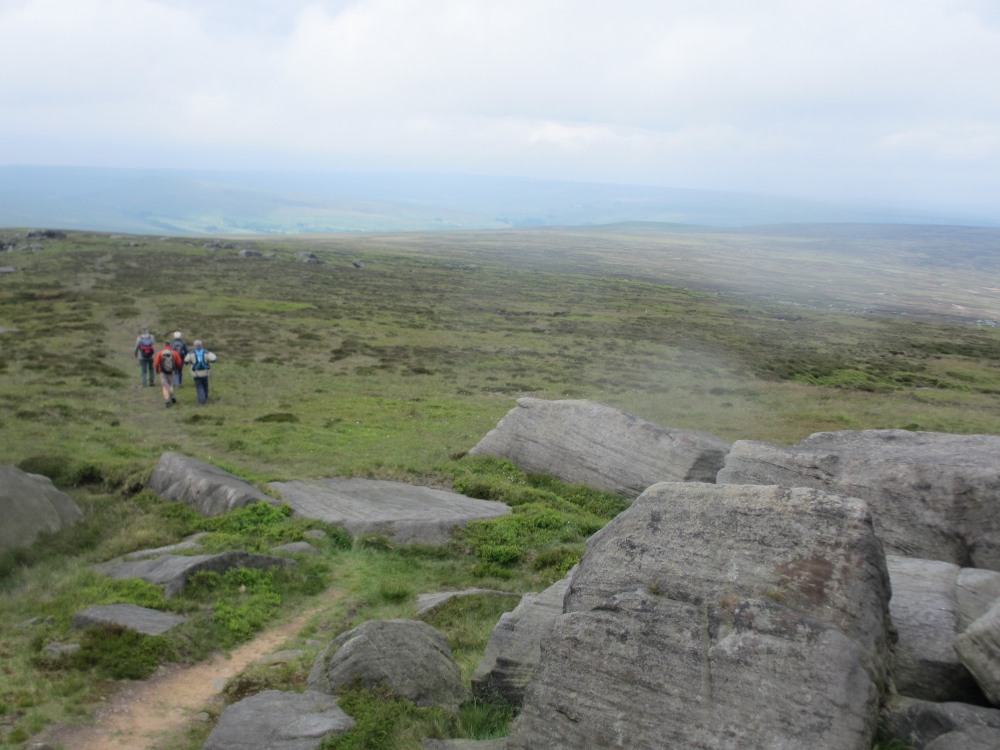
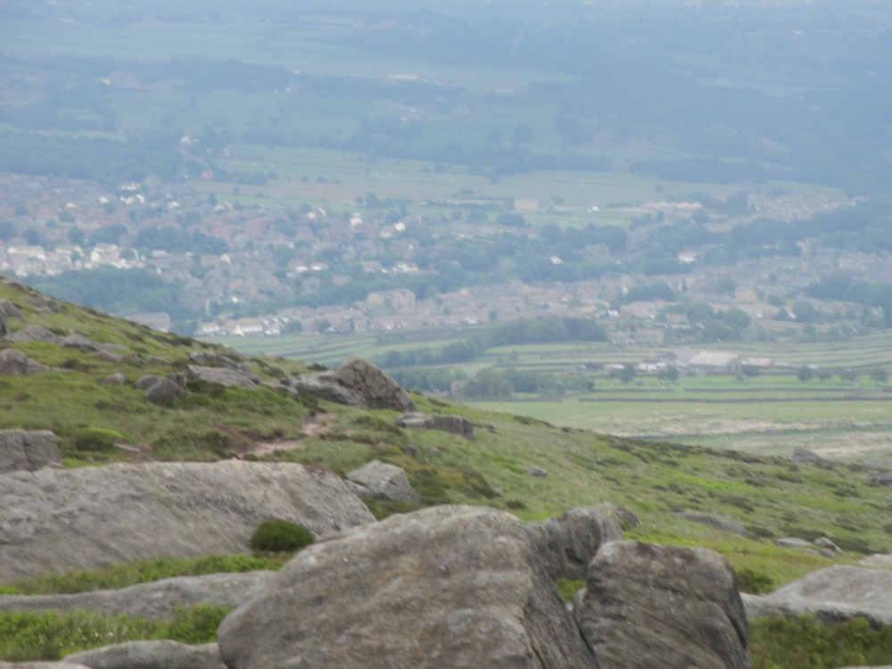
Walk Description: Starting from the main car park by the railway and National Trust office in Marsden, walk down the road into the village, keeping on the main road as it becomes Peel St and follow up to the A62 Manchester Rd. Cross on the pedestrian crossing and continue up Peel St until the main entrance to the park is seen on the left. Enter the park (1), pass the bandstand and climb steps to Carrs Rd. Almost opposite a footpath sign indicates the route, past a cottage and between walls. Continue up between hedges until a path is signed to left which leads into a garden at Lower Scout. Turn right in the garden to exit onto a lane. Turn left and after 50m take path on right, climbing up until a ford on left is reached. Cross the ford and continue along track until just after a wood is reached and take footpath on right. When a stony track is reached follow it uphill, eventually reaching the Deer Hill Conduit. Cross the conduit and follow the track up ahead towards quarries and then follow rough track to right, often boggy in places. After approximately 150m take indistinct footpath to left, heading towards quarry and then turn right following a rough and steep path, keeping a fence to your right until the top of the quarry edge is reached. Turn left briefly to reach level ground and note the fine view over Marsden and beyond. The onward route is generally southward but without a clear path across moorland, which may be boggy. Initially a sunken gully may be followed and this is useful in setting the direction but when this disappears the best guidance is to find vehicle tracks which will head southwards towards West Nab. Note that the ground to the left is out of bounds and there are a number of signs warning of the danger from the shooting range below Deer Hill. The route is heading towards Raven Rocks and there is no one way to reach them. Generally, it may be found preferable to keep to the east (left) of the direct line since this is the usual vehicle route and provides easier access across fences. Approaching Raven Rocks a clear path will be found leading on to the trig point on West Nab. This is an enjoyable escarpment walk with fine views to the west particularly and then for a full 360 deg when West Nab is reached. To return, the same path is used initially but on looking down to the left a path will be seen beyond the northwest side of a fence and descending steeply at first through rocks, becoming an easy path as it descends Leyzing Clough. At the bottom this joins a prominent path above the Pennine Way track and this is followed to the right, eventually reaching the track down to Marsden, used at the start of the walk. A little variation can be introduced by leaving the track as it bends right and taking a path on the left, across a conduit on a bridge and then down to Lower Scout, as passed on the outward route. Return through the park into Marsden.
Other comments and points of interest: (1) The statue in the park commemorates Marsden’s dialect poet Samuel Laycock. He became known as poet of the Lancashire cotton industry but was born in Marsden.
Please include the walk name or number when commenting on an individual walk.